

A very interesting and enjoyable new cooperation was implemented during the lockdown with Sifa Mawiyoo, a student of Cartography at the Technical University of Vienna. In the urgent need of good, detailed maps for our project SHARING WATER, we were extremely happy about this cooperation with someone as professional and dedicated as Sifa.
Sifa, who was born in Nairobi (KEN), studied Geographical Information Systems at Stellenbosch University (ZA). He later worked in data management fields for human and natural resources within the Government of Kenya and the African Wildlife Foundation. He is very attracted by nature, and loves to spend days with his backpack and GPS; hiking new mountains. But he is also very interested in the flow of data – especially in the issue of accessible, open data. He previously supported Kenya’s open data initiative, a service providing access to government data in open formats. In the context of Kenya, this has been a long-winded political and legislative process. The frameworks to make data collected by the government with public funds open by default have been marked by periodic efforts to publish data, a new constitution (2010), access to information act (2016) and data protection act (2019) being the most recent additions. Yet, political will, structures for effective implementation, sustainability and innovation are needed in the long run.
Last year, Sifa began an Erasmus Mundus Cartography Masters course at the European Technical Universities of Munich (DE), Vienna (AT), Dresden (DE) and University of Twente (NL). During the last months, Sifa chose to work on a term project collecting datasets about watersheds, river systems, land use, water discharge and the melting of glaciers for the project SHARING WATER. He was attracted by the project SHARING WATER because of the environmental approach to the topic of water use, and the opportunity to explore and collect data among the highest-ranked countries for open data initiatives in the world; complimented by continent-wide initiatives of EU member states like the European Copernicus Program, which has an astounding record in collecting data about our planet and the environment for the benefit of all European citizens and establishing innovative open access solutions with a user-friendly approach that anyone to access.
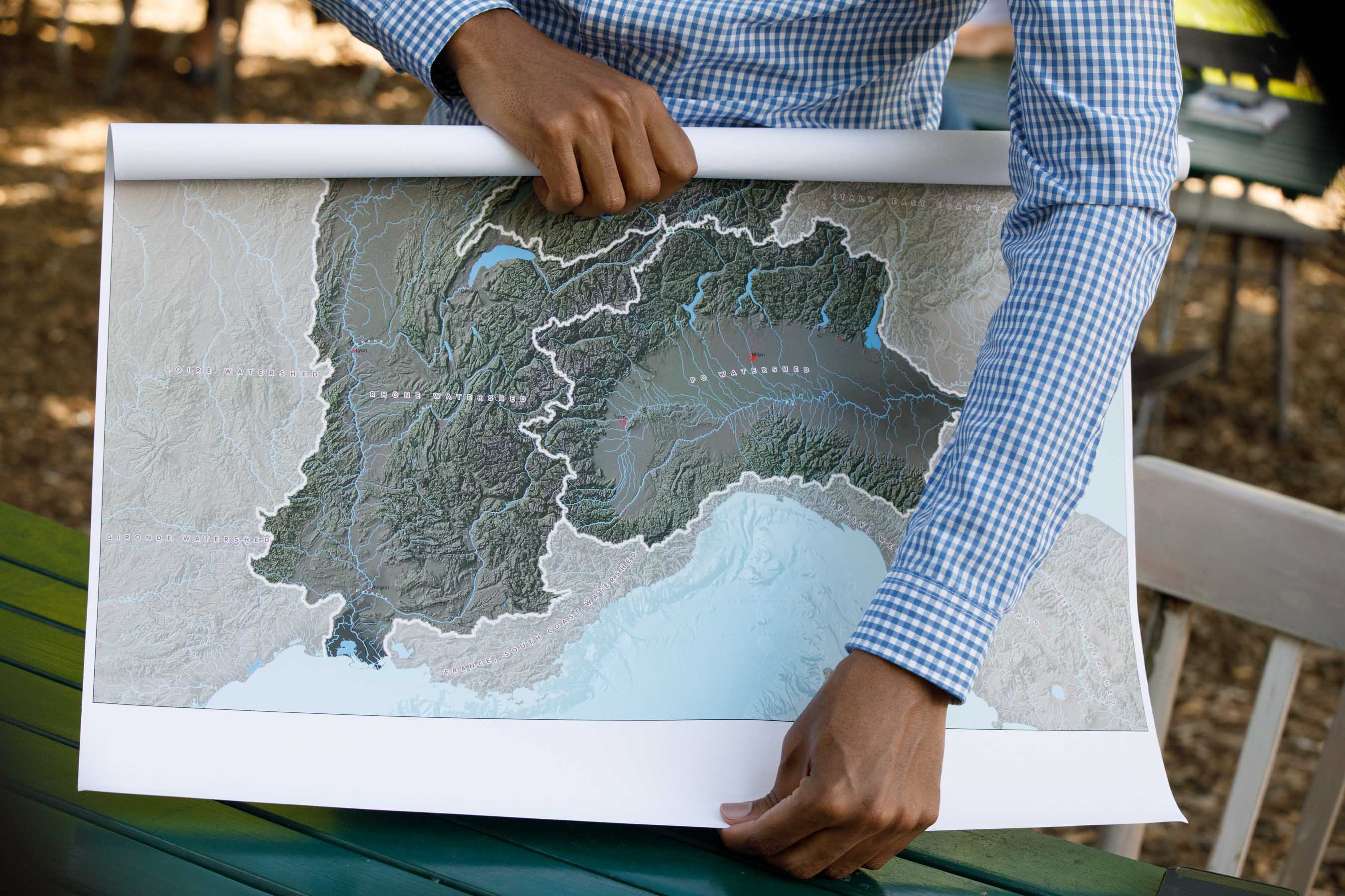
While working on the project, he was impressed by the scale of European rivers, and the quantity of water which flows through the continent and the infrastructure and ecosystems our rivers networks support. With his work, he formed the bridge of cooperation between the Research Division Cartography at TU Wien and SHARING WATER, and we are extremely happy with the results of his work.
Based on the information from Copernicus, European Environmental Agency and other resources, we can work out beautiful and detailed maps for our presentations, exhibition and the book we plan to publish in 2021. We would like to thank you very much, Sifa, and wish you all the best for your future studies and destinations.
#sharingwaterproject #oneearth #waterconnectsus #opendata #dataflow #cartography